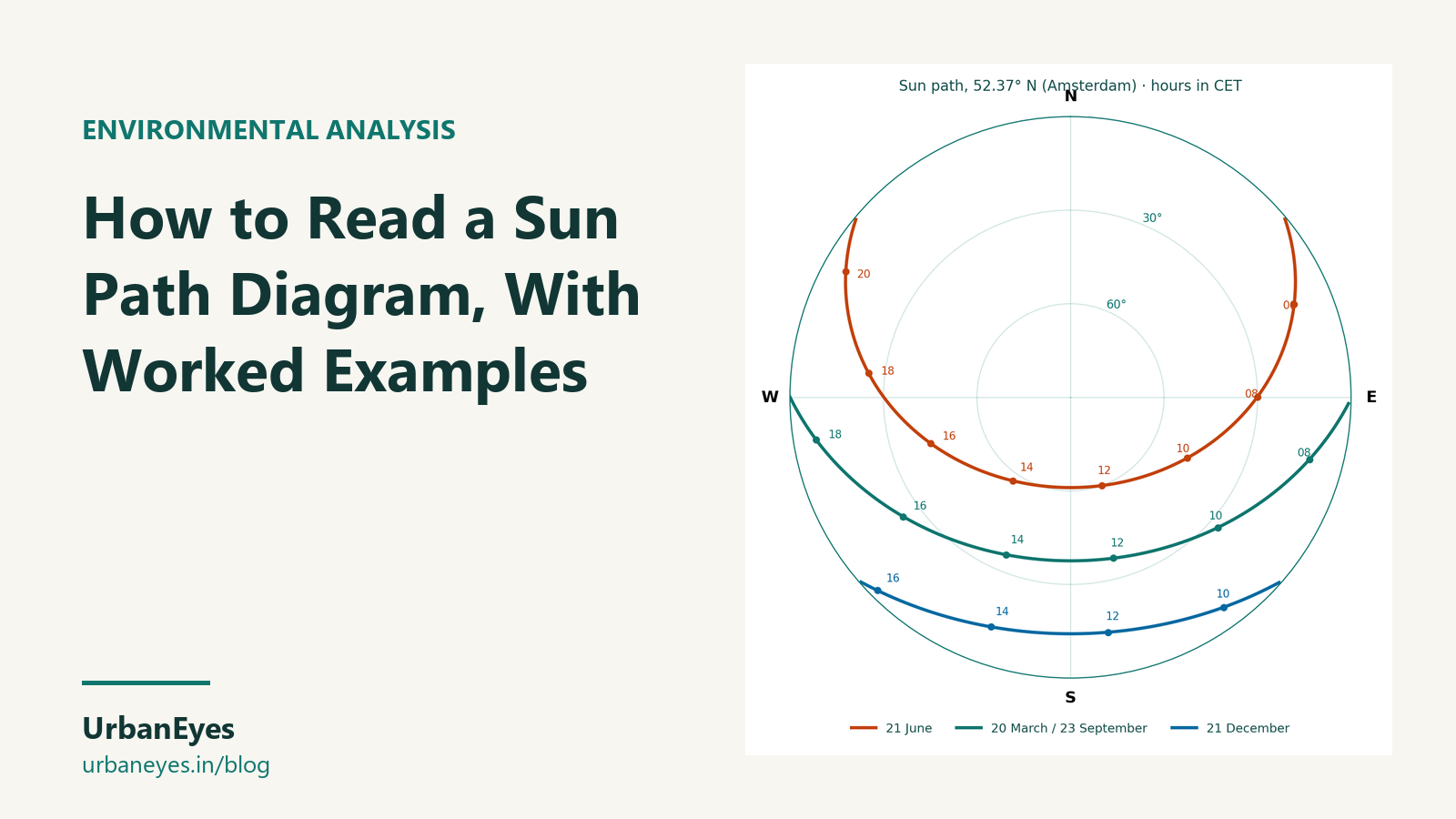
How to Read a Sun Path Diagram, With Worked Examples
A sun path diagram shows where the sun is in the sky at every hour of the year for one latitude. Read the rings as altitude (height above the horizon), the angle round the edge as azimuth (compass direction), and each curve as one day. Use it to place windows, shading and outdoor space, and to work out how long shadows are.
This guide explains how to read one, then works through seven cities from the equator to 60° north so you can see how much latitude changes the design.
Last checked: October 2026. Angles are calculated with the NOAA solar position equations.
What does a sun path diagram show?
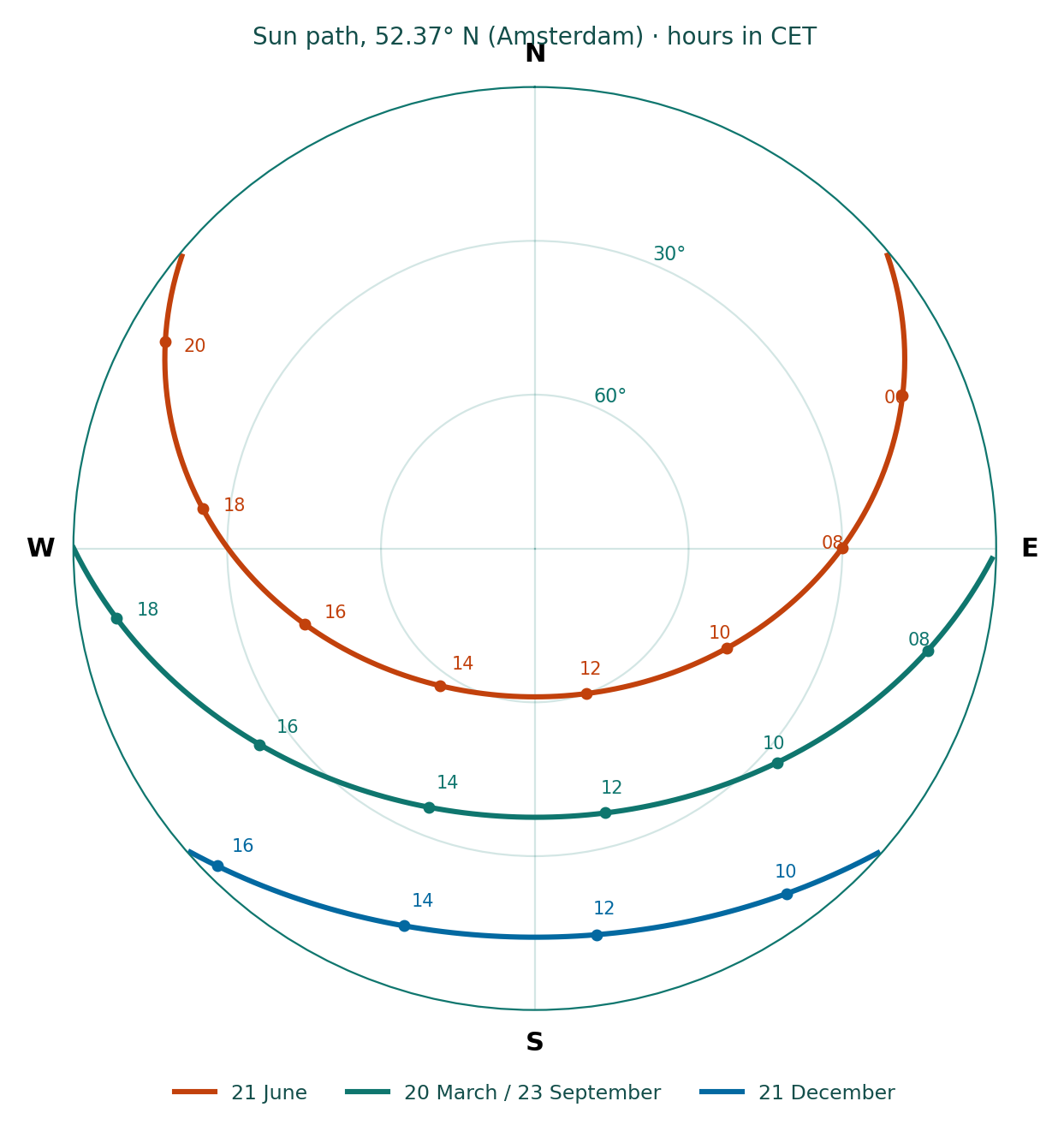
Most site analysis uses a stereographic (circular) diagram:
| Part of the diagram | What it means |
|---|---|
| Centre | Directly overhead (90° altitude) |
| Outer circle | The horizon (0° altitude) |
| Concentric rings | Altitude, usually every 10° |
| Angle round the edge | Azimuth: 0° north, 90° east, 180° south, 270° west |
| Long curves | The sun's path on one day, usually the 21st of each month |
| Short figure-eight lines | The same clock hour through the year |
The highest curve is the summer solstice (21 June in the north), the lowest is the winter solstice (21 December) and the middle is the equinoxes (around 20 March and 22 September), when the sun rises due east and sets due west everywhere.
How do you read a sun path diagram step by step?
- Find the date curve. Pick the month you are testing, for example 21 December.
- Find the hour line. Follow it to where it crosses the date curve, for example 12:00.
- Read the altitude from the rings: how high the sun is.
- Read the azimuth from the edge: which direction it is in.
- Turn it into a design fact. Shadow length is the height of the object divided by the tangent of the altitude. A sun at 15° casts a shadow about 3.7 times the object's height.
The free sun path diagram tool draws this for any address, and the shadow length calculator does step 5 for you.
How does latitude change the sun path?
Noon altitude is 90° minus the difference between your latitude and the sun's declination (+23.44° in June, 0° at the equinox, −23.44° in December). The table shows what that means for seven cities:
| City | Latitude | Noon sun, 21 June | Noon sun, equinox | Noon sun, 21 Dec | Winter shadow at noon (× height) | Day length, 21 Dec |
|---|---|---|---|---|---|---|
| Singapore | 1.4° N | 68° (to the north) | 89° | 65° | 0.5 | about 12 h |
| Mumbai | 19.1° N | 86° | 71° | 47° | 0.9 | about 11 h |
| Dubai | 25.2° N | 88° | 65° | 41° | 1.1 | about 10 h 35 |
| Delhi | 28.6° N | 85° | 61° | 38° | 1.3 | about 10 h 20 |
| London | 51.5° N | 62° | 38° | 15° | 3.7 | about 7 h 50 |
| Amsterdam | 52.4° N | 61° | 38° | 14° | 4.0 | about 7 h 40 |
| Oslo | 59.9° N | 54° | 30° | 7° | 8.6 | about 6 h |
Three things follow:
- Near the equator the sun is overhead all year and in June it is actually north of the zenith in Singapore. Roofs and east and west walls take the heat; south-facing glass is not the priority it is in Europe.
- In the tropics and subtropics (Mumbai, Dubai, Delhi) the summer sun is almost overhead at noon, so horizontal shading over south windows works well, but low east and west sun in the morning and afternoon needs vertical fins or deep reveals.
- At 50° north and above (London, Amsterdam, Oslo) the winter sun is so low that shadows run three to nine times the height of the building. Spacing between blocks, dual-aspect plans and south-facing gardens decide whether homes get sun at all in winter.
Where does the sun rise and set?
Only at the equinoxes does the sun rise due east. In June it rises north of east, and further north the higher your latitude:
| City | Sunrise direction, 21 June | Sunrise direction, 21 Dec |
|---|---|---|
| Delhi | about 63° (east-north-east) | about 117° (east-south-east) |
| London | about 50° (north-east) | about 130° (south-east) |
| Oslo | about 37° (north-east) | about 143° (south-east) |
In London a north-facing room gets early-morning and late-evening sun in June, and none at all from October to March.
How do you use a sun path diagram in site analysis?
- Orientation. Put living rooms where the winter sun reaches them and bedrooms or service rooms where it does not matter.
- Shading. Read the summer altitudes on the facades that overheat and size overhangs and fins to them.
- Overshadowing. Overlay the neighbours' heights: an 18 m building with a 14° sun throws a 71 m shadow.
- Outdoor space. Place gardens, terraces and play areas where the sun falls in the months people use them.
- Solar panels. A common starting tilt is a little below your latitude, facing the equator; in London that means roughly 35° to 40° from horizontal, facing south.
On a real site, the complete site analysis guide shows how a 14° December sun on a Keizersgracht block led to dual-aspect homes with living spaces towards the garden.
Which tools make sun path diagrams?
| Tool | Cost | Best for |
|---|---|---|
| UrbanEyes sun path diagram | Free, in the browser | A quick diagram for any address, plus shadow lengths |
| Ladybug Tools (Grasshopper) | Free, open source | Sun paths, radiation and hours on your own Rhino model |
| Shadowmap | Free tier; paid plans for any date and analytics | Live shadows on real 3D buildings |
| Autodesk Forma Site Design | Paid, 30-day trial | Sun hours and daylight on massing |
| UrbanEyes Site Analysis | From €7.99 per site | Sun, shadow, wind and thermal comfort with the rest of the site analysis |
Prices were read from each vendor's page in October 2026.
Frequently Asked Questions
What is a sun path diagram used for?
To find the sun's position for any date and hour at one latitude, so you can place windows and outdoor space, size shading, check overshadowing and estimate shadow lengths.
How do you read altitude and azimuth on a sun path diagram?
Altitude is read from the concentric rings, from 0° at the outer edge to 90° at the centre. Azimuth is read from the angle round the edge, with north at 0° and south at 180°.
Why is the winter solstice important in site analysis?
It has the lowest sun and longest shadows of the year. If a home or garden gets sun on 21 December, it gets sun all winter.
Does the sun always rise in the east?
Only at the equinoxes does it rise due east. In the northern summer it rises north of east and in winter south of east, more so the further you are from the equator.
How do I calculate shadow length from a sun path diagram?
Divide the object's height by the tangent of the sun's altitude. At 45° the shadow equals the height; at 15° it is about 3.7 times the height.

Chavisha Arora
Co-founder, UrbanEyes
Machine learning engineer, formerly at Tesla and Expedia. Chavisha leads the data and models behind UrbanEyes site analysis.
We analyse, you design.
Run data-backed site analysis with UrbanEyes: maps, metrics, and reports in about 15 minutes.